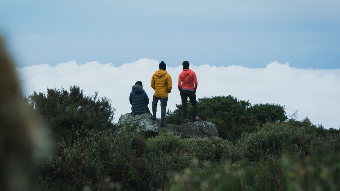
Snapshot
Rongai Route to Mount Kilimanjaro Climb, you can start this route from both the Tanzanian side of the border or from Rongai in Kenya, but all park fees and arrangements must be made at the Marangu gate.
The route may only be used for the ascend and the Marangu route must be used for the descend. The are several big caves along the route, which are used by the porters to overnight for the first two nights.
Inclusions
All transport by private vehicle to and from the mountain
Accommodation as detailed on the itinerary.
Services of a private mountain guide, cook and adequate porters to carry both trip provisions and client’s private bags.
National Park entrance, accommodation and camping fees.
All food and catering equipment – breakfasts, lunches (packed when necessary) and evening meals prepared by our own cook. Special dietary requirements are catered for with prior arrangements at no extra cost.
Certificate of Achievement /appreciation from us.
Free storage of excess baggage not required on the mountain hike.
Crisis management apparatus – VHF 2-way radio/mobile phone, basic first aid kit and an on call vehicle.
Departure dates: Any time with a minimum of two people.
Season: the best times are January to March and June to December.
Scheduled group trips: Daily during best seasons.
Exclusions
Travel and personal accident insurance.
Visa, passport, vaccinations, medicines.
Personal Mountain equipment.
Tips.
Expenditure on alcoholic drinks, souvenirs and other personal items.
Optional excursions not detailed in the itinerary.
Additional optional accommodation added at the base hotel or extra days on the mountain added.
Treated drinking water other than boiled.
Extra costs incurred in case of own intentional change of itinerary while already on trek.
Porters to carry excess of 16Kg. personal luggage per client.
Itinerary
Day 1
LONDOROSSI GATE to MTI MKUBWA (8,692 ft.)
Hike time: 3hrs
Elevation Change +650 M
Estimation distance: 10 km
Final Elevation 2650 M
A three-hour drive from our hotel in Machame brings us to the Londorossi Park Gate located on the western side of Kilimanjaro. At the gate, we pick up our game ranger who will accompany us, as we might encounter elephants and buffaloes during our trek. We drive to the trailhead at Lemosho Glades and start our trek through the rain forest. In places, the vegetation is so untouched that it grows right across the narrow track. The flora and fauna are richer here than on the other morepopular routesthrough therain forest. Our trek today will be along a little used track known as Chamber’s Route. In about 3-4hours, we reach our camp in the rain forest at Mti Mkubwa (Big Tree).
Day 2
MTI MKUBWA to SHIRA ONE CAMP (11,841 ft.)
Hike time: 5 – 6 hrs,
Elevation change +950 M
Estimation distance: 12 km
Final Elevation 3,610 M
After breakfast, we start the climb cross the remaining rain forest towardsthe giant moorland zone. Today is a full day trek with an altitude gain of 2,000 ft. A great lunch stop is One, a beautiful valley just outside the Shira Crater at around 10,000 ft. After lunch, we cross into the Shira Caldera, a high altitude desert plateau that is rarely visited. Shira is the third of Kilimanjaro volcanic cones, and is filled with lava flow from Kibo Peak. The crater rim has been decimated by weather and volcanic action. Today you will get your first close views of Kibo – the dramatic summit of Kilimanjaro.
Day 3
SHIRA ONE CAMP to SHIRA TWO CAMP (12,628 ft.)
Hike time: 5 to 6 hrs Elevation change: +240 M
Elevation distance: 5 km Final elevation: 3,850
After breakfast continue hike east across the Shira Plateau past the Shira Cathedral towards Shira T camp. We only gain 700 feet in elevation – this allows us to acclimatize slowly to the altitude. The views of the plateau are nothing less than spectacular.
Day 4
SHIRA TWO CAMP to BARRANCO HUT (12,956 ft.)
Hike time: 5 hrs
Elevation change: + 100m
Estimated distance: 6km
Final elevation: 3950m
Today is the last of the “easy days”. It is about a 7-hour hike. We pass the Lava Tower, around the southern flank of Kibo, and slowly descend into the spectacular Barranco Valley, interspersed with giant lobelia and senecia plants. After arriving at our most spectacular campsite, everyonestands in awe at the foot of Kibo Peak, looming high above, on our left.Our camp is only 465 feet higher than where we were last night, but during the day, we will have climbed to just over 14,000 feet. This is one of our most valuable days for acclimatization.
Day 5
BARRANCO HUT TO KARANGA VALLEY (13,743 ft.)
Hike time: 3.5 hrs, Elevation
change: +240m (787 ft);
Estimated distance: 4km,
Maximum elevation: 4190m,
Final elevation: 4000m
On the eastern side of the valley, across the stream is the Barranco Wall-a 950ft. barrier of volcanic rock. Although it is tall and looks steep, it is very easy to climb. This is our first challenge of the day. The views from the wall are nothing less than magnificent. The rest of the day is spent skirting the base of Kibo peak over our left shoulder. We descend down into the Karanga Valley, where we rest up for the night before the tough climb up to Barafu hut.
Day 6
BARAFU CAMP (15,088 ft.)
Hike time: 3.5 hrs,
Elevation changes: +410 M (1,345 ft)
Estimated distance: 4km,
Final elevation: 4600 M
First thing, you will be making a steep hike out of the valley. The air starts getting quite thin, and you will be running short of breath. It is a tough, but rewarding uphill to the rocky, craggy slopes at the camp. Barafu means ice in Swahili, and it is extremely cold at this altitude. So, go to bed early because we will be waking you at midnight for the final leg to Uhuru Peak.
Day 7
BARAFU to UHURU PEAK (19,340 ft.) to Mweka CAMP (9,550 ft.) SUMMIT DAY!
Summit time: 7 hrs,
Elevation change: +1300m
Estimated distance: 5km,
Final elevation: 5896m
Descent time: 5 hrs,
Elevation change: -2800m
estimated distance: 12km,
Final elevation: 3100m
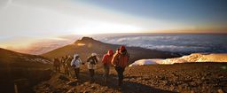
Dress warmly, because we start climbing around midnight, on the steepest and most demanding part of the mountain. The moon, if out, will provide enough light, and we will reach the crater rim by sunrise, after a 7 hour hike, to welcome a new dawn.Fromthecrater rim,rugged Mawenzi Peak is a thrilling sight, with the Kibo saddle still in darkness beneath you, and the crater’s ice-walls looming ahead. We now continue to Uhuru Peak(1-2hrs.) This is the highest point in Africa, and the world’s highest solitary peak (19,340 ft). It is the best view in Africa!
The descent is invigorating. It is a good idea to have a little rest once in a while as you continue down back to Barafu camp (4hours), and then down the Mwekaroute to Mwekacamp(5hours).This is where we spend our last night on the mountain.
Descent time: 4 hrs,
Elevation change: -1250m
estimated distance: 10km,
Final elevation: 1828 M in the morning we walk down to the road head. This takes about 3 – 31/2 hours. After a welcome lunch, it is time to say “kwaheri” to the porters. We then get a transfer back to Arusha to your suggested hotel or onward connection.
Accomodations
1 STAR
BARAFU CAMP, BARRANCO HUT, MTI MKUBWA, Mweka CAMP, SHIRA TWO CAMP or similar
Policies
CLIMATE:
Mount Kilimanjaro is only three degrees south of the Equator so although the climate is technically ‘equatorial’, it is essentially tropical. The long dry season (Jun-Oct) is followed by ?Short Rains? (Nov-Dec). During the short dry season (Jan-Mar) it can be very hot and humid.
The ‘Long Rains’ fall Apr-May. On the mountains, temperatures rise and fall only slightly throughout the year but vary considerably between night and day. Temperatures gradually fall as altitude increases. Above 4,000m, daytime temperature is usually around 5C dropping well below freezing at night.
BAGGAGE:
For your comfort we recommend you travel as light as possible; many airlines impose a maximum weight limit of 20 kg – we advise you to take a lot less!
We would suggest :
One main piece – soft bag rather than a hard suitcase as it can be easily stowed and carried by porters on the ascent. Pack lightly as space is restricted – max. 15kg. NB: any surplus baggage can be stored in Arusha during the ascent – it is vital not to over pack. Please take only bare essentials for the climb.
A daypack – For comfort we recommend a larger daypack or small rucksack with a comfortable harness and waist belt (30-40 litres capacity is ideal for carrying warm clothing, camera, water bottle etc.
CLOTHING AND FOOTWEAR:
It?s essential to keep yourself (and your baggage) dry at all times. Also, to cope with variable temperatures, the best strategy is to layer clothing, so you can adjust your temperature. You should not underestimate the freezing cold conditions you will encounter on the mountain. Although some clothing and equipment is available for hire locally, it?s impossible to guarantee its quality or availability, so equip yourself fully before departure. If you require further advice please contact your mountain climb consultants at: travel@bobbytours.com
The following is a suggestion of what you may find useful to take on this trip. It is not exhaustive and a more detailed packing list can also be found at Suggested Mountain Climb Equipments page.
T-shirts (synthetic materials are best as cotton retains moisture)
Waterproof thigh-length jacket (Goretex or similar)
Gloves (waterproof warm outers + thin liners)
Warm hat (or balaclava) that covers the ears
Waterproof walking boots (well broken-in)
Waterproof outer trousers _ Warm mid-layer (fleece or down)
Warm long-sleeved shirt _ Warm walking trousers (not jeans!)
Thermal underwear _ Walking socks (several pairs)
Walking shorts
Trainers or soft shoes for relaxing
Sun-hat
Gaiters
EQUIPMENT:
Glacier glasses (or good quality sunglasses ? preferably with side shields)
Personal first aid kit & essential medication
Wet wipes
Warm sleeping bag (3/4-season)
Sleeping bag liner
Trekking pole(s) – can be hired locally
Small towel
Headtorch & spare batteries
Spare plastic bags
Waterbottle(s) – minimum 3 litres capacity
High factor sunscreen & lipsalve
High energy snacks, dried fruit, nuts, sweets, etc. NB: hang on to some till the last day – you?ll appreciate them more!
A small bottle of cordial or squash concentrate (to liven up the ?flat? taste of boiled water)
MEALS
6 breakfasts, 6 lunches and 5 evening meals are included.
TIPPING:
Tipping is an accepted part of life in Tanzania, and you will be expected to tip to reward service. You will be briefed on arrival as to when and how much is appropriate, however, depending on the size of your group you should budget on a personal contribution of around $ 45 to $ 50 for your trek guides, cooks and porters on the trek.
CLIMATE CHART
Arusha (1,390m) Jan Feb Mar Apr May Jun Jul Aug Sep Oct Nov Dec
Temperature: average high/low C 28/13 28/14 27/15 25/16 23/15 22/13 22/12 23/12 25/13 27/14 27/14 27/14
Rain: average monthly mm 66 77 138 223 83 17 8 7 8 24 119 103
Reviews
No reviews